My Genealogy Hound
Boone County, Arkansas 1889 Map
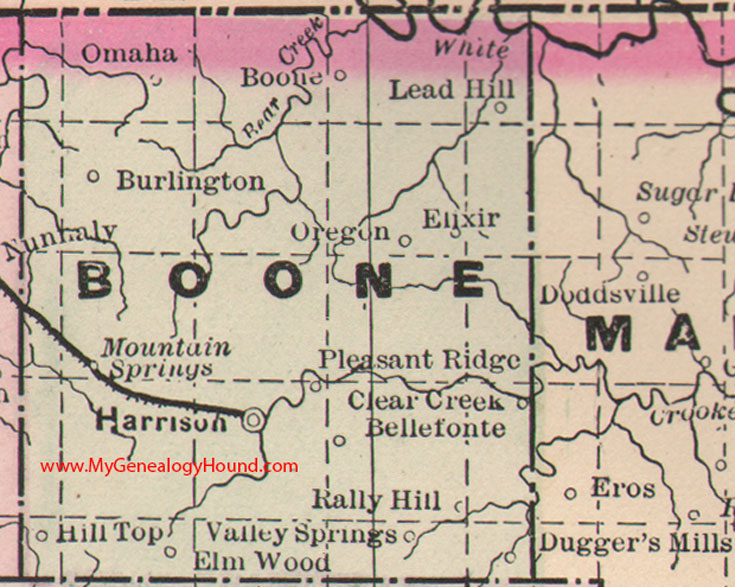
Locations shown include: Bellefonte, Boone, Burlington, Clear Creek, Dugger's Mills, Elixer, Elm Wood, Harrison, Hill Top, Lead Hill, Mountain Springs, Omaha, Oregon, Pleasant Ridge, Rally Hill, Valley Springs
This is a portion of a Arkansas map published by Bradley, circa 1889.
View additional Arkansas Maps here: Arkansas County Maps
County maps from other states can be viewed here: State County Maps
Additional Boone County resources: A Reminiscent History of The Ozark Region
Use the links at the top right of this page to search or browse thousands of family biographies.