My Genealogy Hound
Clay County, Arkansas 1889 Map
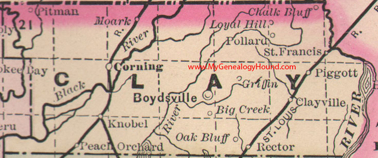
Locations shown include: Big Creek, Boydsville, Chalk Bluff, Clayville, Corning, Griffin, Knobel, Loyal Hill, Moark, Oak Bluff, Peach Orchard, Piggott, Pitman, Pollard, Rector, St. Francis
This is a portion of a Arkansas map published by Bradley, circa 1889.
View additional Arkansas Maps here: Arkansas County Maps
County maps from other states can be viewed here: State County Maps
View Clay County, Arkansas family biographies from 1889 here: Clay County, Arkansas Biographies
Additional Clay County resources: Clay County, Arkansas History, Genealogy, and Maps
Use the links at the top right of this page to search or browse thousands of family biographies.