My Genealogy Hound
Cleburne County, Arkansas 1889 Map
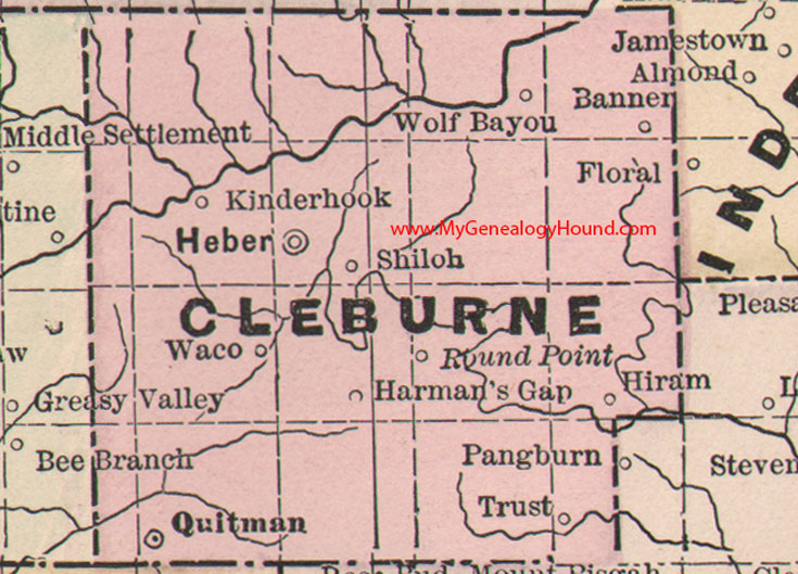
Locations shown include: Banner, Harman's Gap, Heber, Hiram, Kinderhook, Quitman, Round Point, Shiloh, Trust, Waco, Wolf Bayou
This is a portion of a Arkansas map published by Bradley, circa 1889.
View additional Arkansas Maps here: Arkansas County Maps
County maps from other states can be viewed here: State County Maps
Additional Cleburne County resources: A Reminiscent History of The Ozark Region
Use the links at the top right of this page to search or browse thousands of family biographies.