My Genealogy Hound
Crawford County, Arkansas 1889 Map
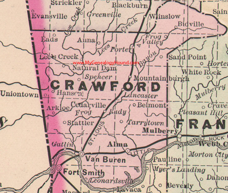
Locations shown include: Alma, Anna, Arkloe, Belmont, Bidville, Cedarville, Eads, Frog Valley, Gatlin, Hanson, Lancaster, Lee's Creek, Leonardsville, Mountainburgh, Natural Dam, Porter, Rudy, Sand Point, Spencer, Stattler, Tarrytown, Uniontown, Van Buren
This is a portion of a Arkansas map published by Bradley, circa 1889.
View family biographies from the 1889 History of Crawford County, Arkansas: Crawford County, Arkansas
View additional Arkansas Maps here: Arkansas County Maps
County maps from other states can be viewed here: State County Maps
Additional Crawford County resources: Crawford County, Arkansas History, Genealogy, and Maps
Use the links at the top right of this page to search or browse thousands of family biographies.