My Genealogy Hound
Prairie County, Arkansas 1889 Map
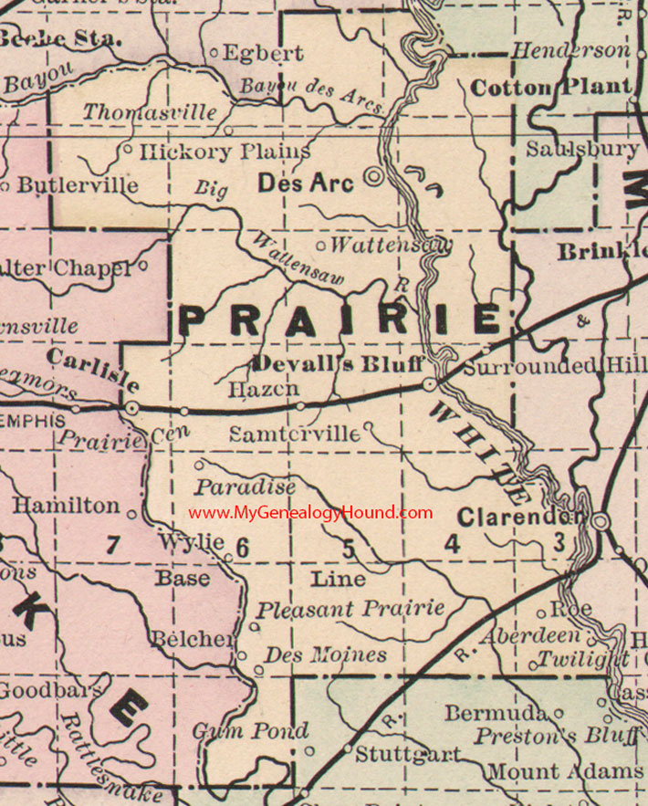
Locations shown include: Aberdeen, Belcher, Carlisle, Des Arc, Des Moines, Devall's Bluff, Hazen, Hickory Plains, Paradise, Pleasant Prairie, Prairie Center, Roe, Samterville, Surrounded Hill, Thomasville, Twilight, Wattensaw, Wylie
This is a portion of a Arkansas map published by Bradley, circa 1889.
View family biographies from the 1890 History of Prairie County: Prairie County, Arkansas
View additional Arkansas Maps here: Arkansas County Maps
County maps from other states can be viewed here: State County Maps
Additional Prairie County resources: Prairie County, Arkansas History, Genealogy, and Maps
Use the links at the top right of this page to search or browse thousands of family biographies.