My Genealogy Hound
LaSalle County, Illinois 1870 Map
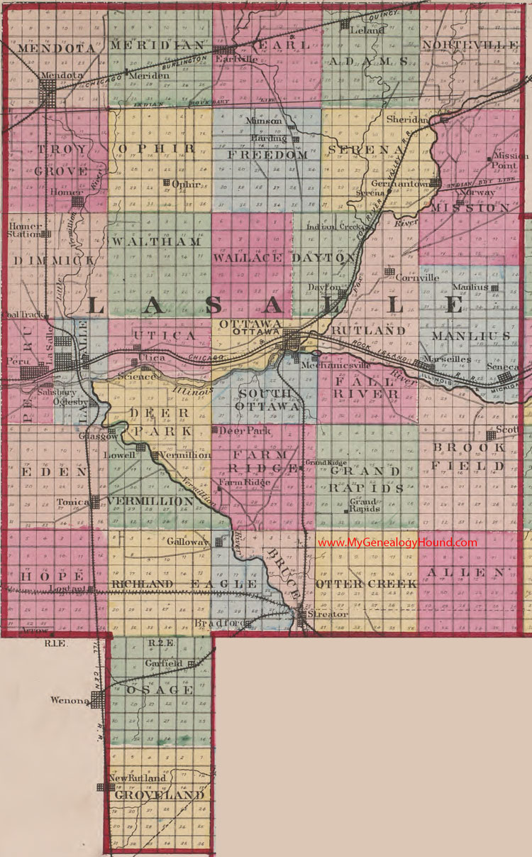
Locations shown include: Arrow, Bradford, Cornville, Dayton, Deer Park, Earlville, Farm Ridge, Galloway, Garfield, Germantown, Glasgow, Grand Rapids, Grand Ridge, Harding, Homer, Homer Station, Indian Creek, LaSalle, Leland, Lostant, Lowell, Manlius, Marseilles, Mechanicsville, Mendota, Meriden, Mimson, Mission Point, New Rutland, Norway, Oglesby, Ottawa, Peru, Salisbury, Science, Scott, Seneca, Serena, Sheridan, Streator, Tonica, Utica, Vermillion
The names shown in all caps are the names of the townships
This a portion of a map from Atlas of Illinois, by Warner & Beers, 1870
View additional Illinois Maps here: Illinois County Maps
County maps from other states can be viewed here: State County Maps
Additional LaSalle County resources: LaSalle County, Illinois History and Genealogy
Use the links at the top right of this page to search or browse thousands of family biographies.