My Genealogy Hound
St. Clair County, Illinois 1870 Map
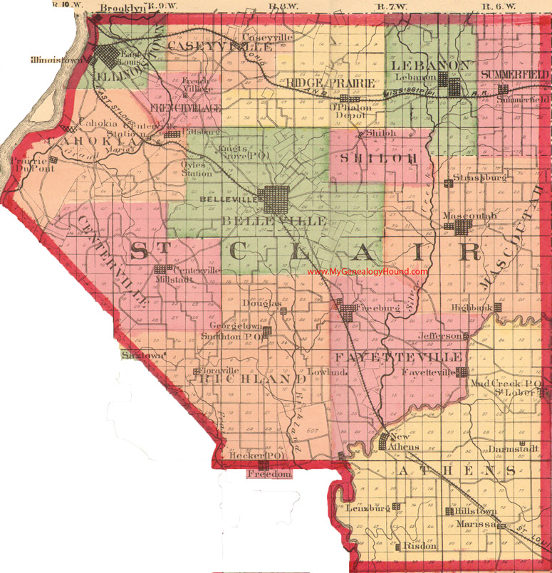
Locations shown include: Belleville, Brooklyn, Cahokia, Caseyville, Centerville, Centerville Station, Darmstadt, Douglas, East St. Louis, Fayetteville, Floraville, Freeburg, French Village, Georgetown, Gyles Station, Highbank, Hillstown, Illinoistown, Jefferson, Knights Grove, Lebanon, Lenzburg, Lowland, Mad Creek, Marissa, Maseoutah, Millstadt, New Athens, O'Phalon Depot, Pittsburg, Prairie DuPont, Risdon, St. Lober, Saxtown, Shiloh, Smithton, Strasburg, Summerfield
The names shown in all caps are the names of the townships
This a portion of a map from Atlas of Illinois, by Warner & Beers, 1870
View additional Illinois Maps here: Illinois County Maps
County maps from other states can be viewed here: State County Maps
Additional St. Clair County resources: St. Clair County, Illinois History, Genealogy, and Maps
Use the links at the top right of this page to search or browse thousands of family biographies.