My Genealogy Hound
Cherokee County, Kansas 1887 Map
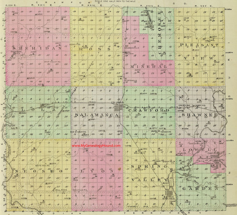
Locations shown include (click on any township name for an enlarged view):
Cherokee Township: Leawalk, Weir City
Crawford Township: Tehama
Garden Township: Kark, Lowell
Lola Township: Hallowell
Lowell Township: Bonanza, Boston Mills, Empire City, Galena
Lyon Township: Keelville
Mineral Township: Scammonville, Stilson, Stippsville
Neosho Township: Mill Rose, White Hall
Pleasant View Township: Neutral City
Ross Township: Cherry
Salamanca Township: Columbus, New Windsor
Shawnee Township: Crestline, Messer
Sheridan Township: Sherman City, Star Valley
Spring Valley Township: Baxter Springs, Neutral, Quaker Vale
The names shown in all caps are the names of the townships
This a map from Official State Atlas of Kansas, by L. H. Everts & Co., 1887
View family biographies from the 1883 History of Cherokee County: Cherokee County, Kansas
View additional Kansas Maps here: Kansas County Maps
County maps from other states can be viewed here: State County Maps
Additional Cherokee County resources: Cherokee County, Kansas History, Genealogy, and Maps
Use the links at the top right of this page to search or browse thousands of family biographies.