My Genealogy Hound
Graves County, Kentucky 1905 Map
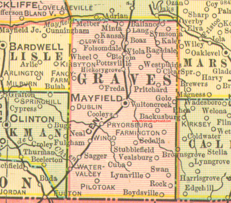
Locations shown include: Ballance, Bloom, Boaz, Boydsville, Clear Spring, Cooleys, Cuba, Dublin, Fancy Farm, Farmington, Folsomdale, Freda, Golo, Hickory Grove, Kaler, Kansas, Lang, Lowes, Lynnville, Mayfield, Minta, Pilot Oak, Pottsville, Pritchard, Ragsdale, Rock, Sagger, Sedalia, Stubblefield, Swan, Symsonia, Vealsburg, Viola, Vulton Creek, Water Valley, West Plains, Wheel, Wingo
This a portion of a Kentucky map from Cram's Ideal Reference Atlas, 1905
View Graves County family biographies from the 1885 History of Kentucky, edition 1: Graves County, Kentucky
View additional Kentucky Maps here: Kentucky County Maps
County maps from other states can be viewed here: State County Maps
Additional Graves County resources: Graves County, Kentucky History and Genealogy
Use the links at the top right of this page to search or browse thousands of family biographies.