My Genealogy Hound
Jefferson County, Kentucky 1905 Map
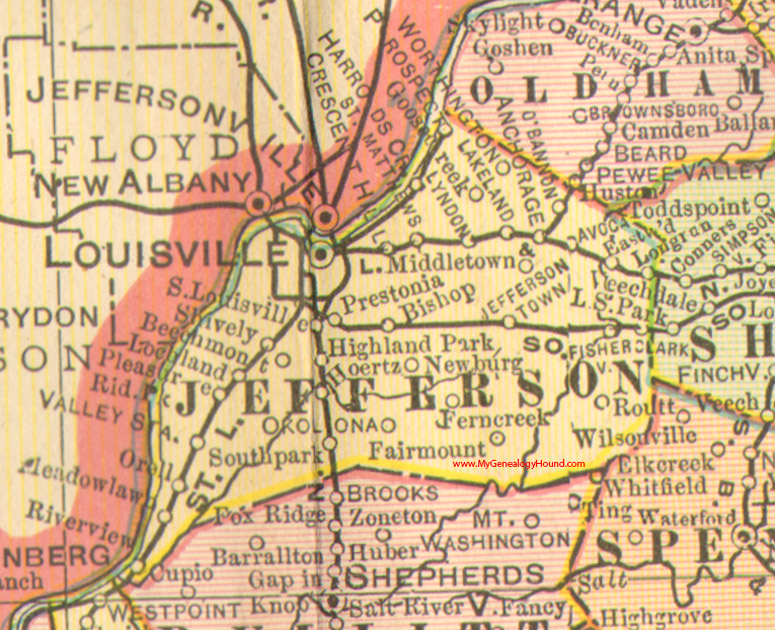
Locations shown include: Anchorage, Avoca, Beechmont, Bishop, Clark, Crescent Hill, Eastwood, Fairmount, Fern Creek, Fisherville, Goose Creek, Harrods Creek, Hoertz, Jeffersontown, Lakeland, Lochland, Long Run, Louisville, Lyndon, Meadow Lawn, Middletown, Newburg, O'Bannon, Okolona, Orell, Pleasure Ridge Park, Prestonia, Prospect, Riverview, Routt, St. Matthews, Shively, South Louisville, Southpark, Valley Station, Worthington
This a portion of a Kentucky map from Cram's Ideal Reference Atlas, 1905
View Jefferson County family biographies from the 1885 History of Kentucky, edition 8a: Jefferson County, Kentucky
View additional Kentucky Maps here: Kentucky County Maps
County maps from other states can be viewed here: State County Maps
Additional Jefferson County resources: Jefferson County, Kentucky History and Genealogy
Use the links at the top right of this page to search or browse thousands of family biographies.