My Genealogy Hound
Meade County, Kentucky 1905 Map
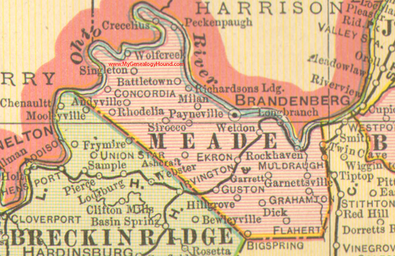
Locations shown include: Andyville, Ashcraft, Battletown, Big Spring, Brandenburg (Brandenberg), Concordia, Crecelius, Dick, Ekron, Flaherty, Garnettsville, Garrett, Grahamton, Guston, Hill Grove, Long Branch, Milan, Muldraugh, Payneville, Peckinpaugh, Rhodelia, Richardsons Landing, Rock Haven, Singleton, Sirocco, Twin Cave, Weldon, Wolf Creek
This a portion of a Kentucky map from Cram's Ideal Reference Atlas, 1905
View additional Kentucky Maps here: Kentucky County Maps
County maps from other states can be viewed here: State County Maps
Additional Meade County resources: Meade County, Kentucky History and Genealogy
Use the links at the top right of this page to search or browse thousands of family biographies.