My Genealogy Hound
Union County, Kentucky 1905 Map
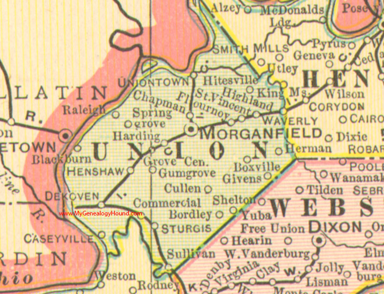
Locations shown include: Blackburn, Bordley, Boxville, Caseyville, Chapman, Commercial, Cullen, Dekoven, Flournoy, Givens, Grove Center, Gum Grove, Harding, Henshaw, Herman, Highland, Hitesville, Morganfield, Raleigh, St. Vincent, Spring Grove, Sturgis, Sullivan, Uniontown, Waverly, Yuba
This a portion of a Kentucky map from Cram's Ideal Reference Atlas, 1905
View additional Kentucky Maps here: Kentucky County Maps
County maps from other states can be viewed here: State County Maps
Additional Union County resources: Union County, Kentucky History and Genealogy
Use the links at the top right of this page to search or browse thousands of family biographies.