My Genealogy Hound
Giles County, Tennessee 1888 Map
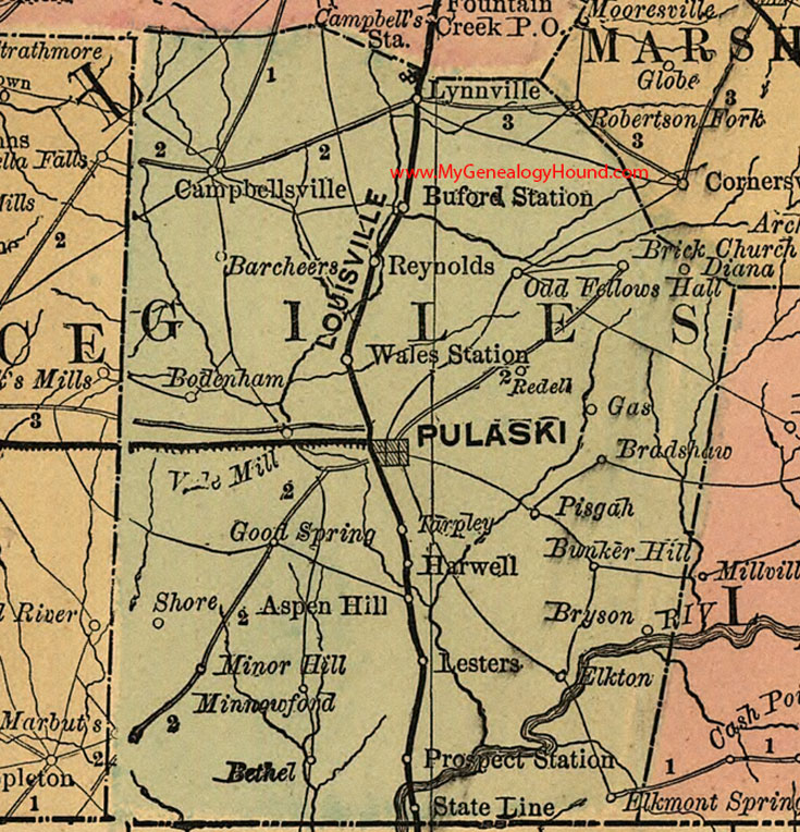
Locations shown include: Aspen Hill, Barcheers, Bethel, Bodenham, Bradshaw, Brick Church, Bryson, Buford Station, Bunker Hill, Campbellsville, Diana, Elkmont Spring, Elkton, Gas, Good Spring, Harwell, Lesters, Lynnville, Marbuts, Minnowford, Minor Hill, Odd Fellows Hall, Pisgah, Prospect Station, Pulaski, Redell, Reynolds, Shore, State Line, Tarpley, Vale Mill, Wales Station
This a portion of a Tennessee map by Rand, McNally & Co. 1882, 1888
View family biographies from the 1886 History of Giles County: Giles County, Tennessee
View additional Tennessee Maps here: Tennessee County Maps
County maps from other states can be viewed here: State County Maps
Additional Giles County resources: Giles County, Tennessee History and Genealogy
Use the links at the top right of this page to search or browse thousands of family biographies.