My Genealogy Hound
Grainger County, Tennessee 1888 Map
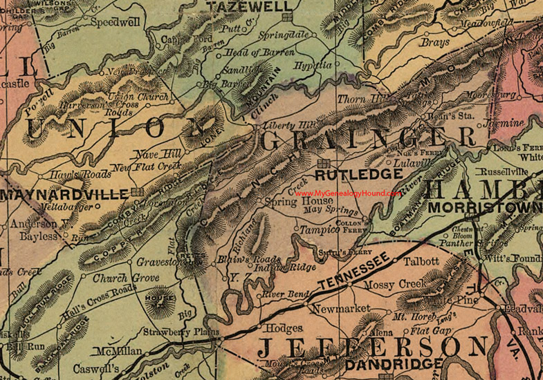
Locations shown include: Bean's Station, Blain's Roads, Collon's Ferry, Indian Ridge, Jarmine, Liberty Hill, Lulaville, May Springs, Noe's Ferry, Rutledge, Smfru's Ferry, Spring House, Tampico, Thorn Hill, Y. Z.
This a portion of a Tennessee map by Rand, McNally & Co. 1882, 1888
View additional Tennessee Maps here: Tennessee County Maps
County maps from other states can be viewed here: State County Maps
Additional Grainger County resources: Grainger County, Tennessee History and Genealogy
Use the links at the top right of this page to search or browse thousands of family biographies.