My Genealogy Hound
Hardin County, Tennessee 1888 Map
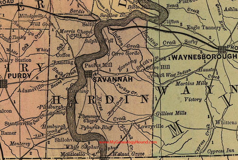
Locations shown include: Cerro Gordo, Coffee Landing, Crumps Landing, Economy, Gillises Mills, Hamburgh, Lowryville, Monticello, Morris Chapel, Olive Hill, Paulks Mill, Pittsburgh Landing, Plummers Chapel, Pyburns Bluff, Red Sulphur, Saltillo, Savannah, Shilohville, Smith's Fork, Smith West, Snake, Sulphur Well, Walnut Grove, White Sulphur
This a portion of a Tennessee map by Rand, McNally & Co. 1882, 1888
View additional Tennessee Maps here: Tennessee County Maps
County maps from other states can be viewed here: State County Maps
Additional Hardin County resources: Hardin County, Tennessee History and Genealogy
Use the links at the top right of this page to search or browse thousands of family biographies.