My Genealogy Hound
Knox County, Tennessee 1888 Map
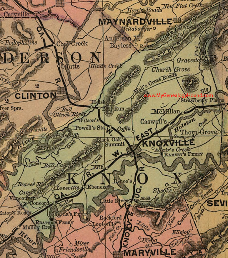
Locations shown include: Adair's Creek, Ball Camp, Beaver Ridge, Black Oak Summit, Bruce's, Bull Run, Campbell, Caswell's, Church Grove, Coffin, Concord, Ebenezer, Erin, Graveston, Hall's Cross Roads, Knoxville, Little River, Loveville, McMillan, Powell's Station, Shooks, Thorn Grove
This a portion of a Tennessee map by Rand, McNally & Co. 1882, 1888
View additional Tennessee Maps here: Tennessee County Maps
County maps from other states can be viewed here: State County Maps
Additional Knox County resources: Knox County, Tennessee History, Genealogy, and Maps
Use the links at the top right of this page to search or browse thousands of family biographies.