My Genealogy Hound
Montgomery County, Tennessee 1888 Map
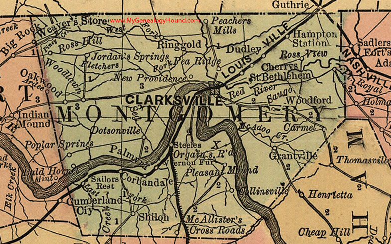
Locations shown include: Ardee, Bald Hornet, Carmel, Cherrys, Clarksville, Collinsville, Corbandale, Dotsonville, Dudley, Grantville, Hampton Station, Jordan's Springs, McAllister's Cross Roads, New Providence, Oakwood, Orgains Crossroads, Palmyra, Pea Ridge, Peachers Mills, Pleasant Mound, Port Royal, Ringgold, Ross Hill, Ross View, Sailors Rest, St. Bethlehem, Saugo, Shiloh, Steeles, Vernon Fur, Woodford, Woodlawn
This a portion of a Tennessee map by Rand, McNally & Co. 1882, 1888
View additional Tennessee Maps here: Tennessee County Maps
County maps from other states can be viewed here: State County Maps
Additional Montgomery County resources: Montgomery County, Tennessee History and Genealogy
Use the links at the top right of this page to search or browse thousands of family biographies.