My Genealogy Hound
Shelby County, Tennessee 1888 Map
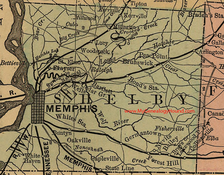
Locations shown include: Bailey, Bartlett, Bettieville, Bond's Station, Brays (or Lakewood Station), Brunswick, Buntyn, Capleville, Cedar Gr., Cemetery, Colliersville, Cuba, Fisherville, Forest Hill, Frayser, Germantown, Kerrville, Lucy, Memphis, Millington, Millwood, Nevits, Oakville, Pea Point, Raleigh, St. Elmo, State Line, Wells, White Haven, Whites Station, Woodstock
This a portion of a Tennessee map by Rand, McNally & Co. 1882, 1888
View additional Tennessee Maps here: Tennessee County Maps
County maps from other states can be viewed here: State County Maps
Additional Shelby County resources: Shelby County, Tennessee History, Genealogy and Maps
Use the links at the top right of this page to search or browse thousands of family biographies.